How Laser Scanning Helps with Urban Development
posted 6th December 2024
Imagine having a digital replica of your urban development project that captures every detail with millimetre accuracy. This is how laser scanning helps with urban development. Thorough and precise development planning is essential and 3D laser scanning technology can help you throughout the process.
What is 3D Laser Scanning?
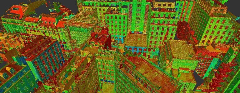
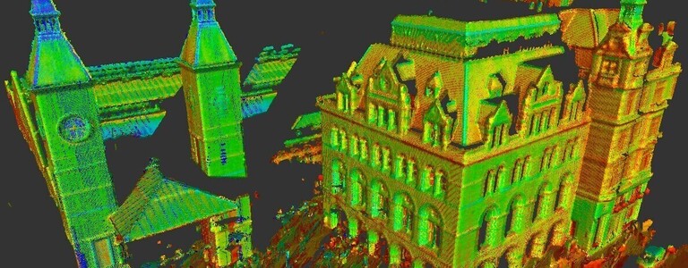
3D laser scanning is a sophisticated device that sends out light pulses, capturing millions of data points over a designated area. The data is then converted using specialist software to create a detailed and interactive replica of your land, this is a 3D point cloud. It provides accurate information regarding the topography, vegetation, and any man-made structures on the piece of land you want to develop.
The models can then be used by architects, engineers, construction teams, and estate agents.
How Laser Scanning Helps with Urban Development
Laser scanning has proven beneficial in the world of land surveying, revolutionising urban development.
Enhanced Accuracy
Compared to traditional surveying methods, laser scanning offers excellent accuracy, reducing errors and rework that comes with human mistakes. The scanners capture data accurately and quickly, providing accurate measurements and distances, providing an efficient solution that enables your project to go ahead seamlessly.
Reduce Costs
3D laser scanning provides a better return on your investment when it comes to urban developments. You can focus on spending your money on upgraded finishes or additional amenities, thanks to faster time lines and money saved from errors and reworks.
Improved Planning and Design
The survey improved the planning and design stages. Used by architects, engineers, and developers, the point clouds enable these professionals to visualise the site, optimising layouts, minimising excavation, and identifying potential problems during the early stages of the project.
Informed Choices
Laser scanning surveys offer in-depth analysis of the plot of land, enabling you to make informed decisions throughout the development. It ensures teams can accurately assess the feasibility of the site, planning infrastructure, and optimising the design for aesthetics and functionality.
As-Built Documentation
As-built surveying is valuable throughout your urban development process. It captures data throughout the construction process, providing a replica that enables you to identify the exact location of pipes, cables, and other infrastructure. This can save time and money when it comes to future maintenance projects and renovations.
Conclusion
Unleash the potential of your urban development with accurate 3D laser scanning surveys. At MB Survey Solutions, we provide years of experience offering surveys to ensure your development project goes ahead seamlessly. Get in touch with us today and let us turn your urban development vision into a reality.
