


How do you integrate new technology into your services?
posted 19th August 2024
As surveyors, we use a host of state of the art technology to provide you with accurate surveys, whether you need a topographical survey, as-built survey, or a measured building survey.
With over twenty five years experience, the team at MB Survey Solutions, use traditional methods of surveying, along with using the latest technology, offering a faster and more accurate surveying solution, ensuring you receive precise measurements and data that you can trust when it comes to your construction project, whether you are building a new property, or extending your existing home.
What Equipment Do We Use to Carry Out Surveys?
We use a number of different pieces of equipment. Every property is unique, whether it's a plot of land or an existing structure. As a result, we use different piece of equipment based on the survey being carried out, along with the property itself. Some of the new technologies we have integrated into your surveying processes include:
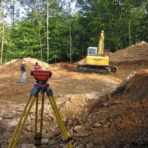
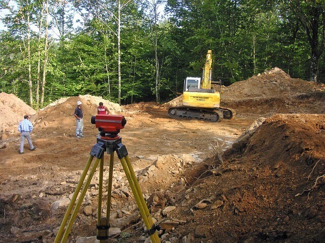
Total Stations
Total stations are an important piece of kid helping us accurately measure angles, dimensions, and heights. These stations use angled measurements to determine coordinates and distances with great accuracy. We use the data collected from the total station to provide floor plans and elevation drawings for architects and engineers.
Theodolite
Theodolites are very effective in measuring vertical and horizontal angles. It is a telescope on a mount, which is a valuable piece of equipment in our surveying kit. It helps us measure an objects angle on various axes by simply pointing the telescope at the desired target. The digital screen shows precise information that we can use to complete your survey.
3D Laser Scanners
3D laser scanners have been a great addition to our equipment selection, very similar to a total station. They use a laser that pulses at an item, the beam is reflected back to the device. It times how long it takes for the beam to make impact and reflect back, calculating the distance between the scanner and the target. Our 3D laser scanner is able to capture thousands of data points a second with great precision.
Drones
Yes drones have made it into the surveying industry, these remote controlled aerial vehicles are ideal for taking photographs with measurement capabilities. They can hover, taking pictures from various viewpoints and angles. They help us to access hard to reach or inaccessible areas of a property.
Measuring Wheel
While measuring wheels are not new technology, they are a valuable piece of equipment that we use to determine distance travelled. We use this when we have an area we cannot measure with our 3D laser scanner, for example
GPS Receivers
When carrying out outdoor surveys, we use GPS to obtain accurate geographic coordinates. They provide accurate location data of the plot of land or building, enabling us to record locations and orientations, helping with the mapping process.
Conclusion
Thanks to advancements in technology, we are able to provide high quality surveys with excellent accuracy in a shorter period of time. 3D laser scanners, drones, and GPS has all transformed the surveying industry. At MB Survey Solutions, we stay updated with the latest technologies and trends in our area, ensuring you always receive a high quality and accurate survey that you can trust when it comes to your construction project.